Last update: 09/25/2023
Rota Vicentina trails in the areas of S. Teotónio, Odeceixe and Bordeira affected by the August fires
Status Update
All maintenance (marking, posts and path cleanings) of the Walking Trails and Mountain Biking routes has already been completed, with only the reconstruction of the bridge over the Seixe stream remaining, in S. Teotónio » Odeceixe section of the Historical Way. In S. Teotónio » Odeceixe section, of the Historical Way, we recommend that you conclude your walk in the village of S. Miguel, or proceed along the road to Odeceixe.
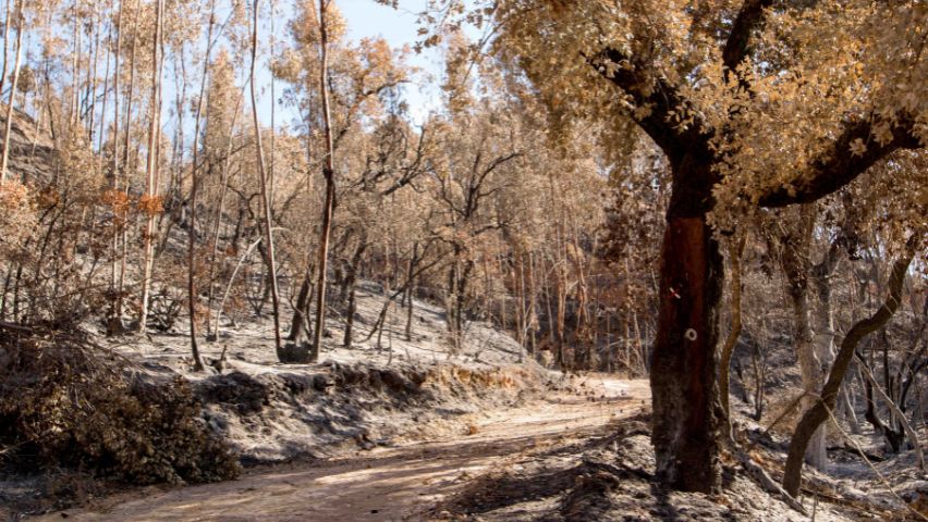
The beginning of August was marked by a painful and impactful event: two major fires (almost simultaneously) affected Rota Vicentina trails in two distinct areas.
In S. Teotónio and Odeceixe
The fire that started on Saturday, August 5th (at 2:49 PM), in Baiona, inflicted considerable damage and extended for several days (until August 13th). Although it has been declared extinguished, the surrounding areas remain under surveillance, with the presence of firefighters.
During the critical days, there were simultaneously 1121 professionals, 16 aerial units and 371 ground vehicles on the field. The fire presented three active fronts, resulting in temporary road closures and the activation of the Odemira Municipal Emergency Plan. The burned area reached 7528 hectares.
In these areas, covering pine forests and mixed vegetation such as eucalyptus, cork oaks, strawberry trees and shrubs, where some of the Walking and Cycling Trails of Rota Vicentina are also located.
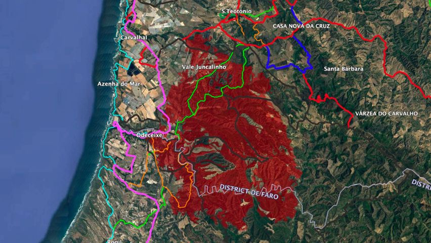
The red area represents the entirety of the burned area in the municipalities of Odemira, Aljezur, and Monchique. Source: ICNF.
In Bordeira
Also close to Rota Vicentina trails, a second fire broke out on August 7th and it was extinguished the following day. This fire mobilized the efforts of 62 operatives, 16 ground vehicles,and 3 aerial units. 187 hectares of area (mainly brushwood and pine forest) were affected.
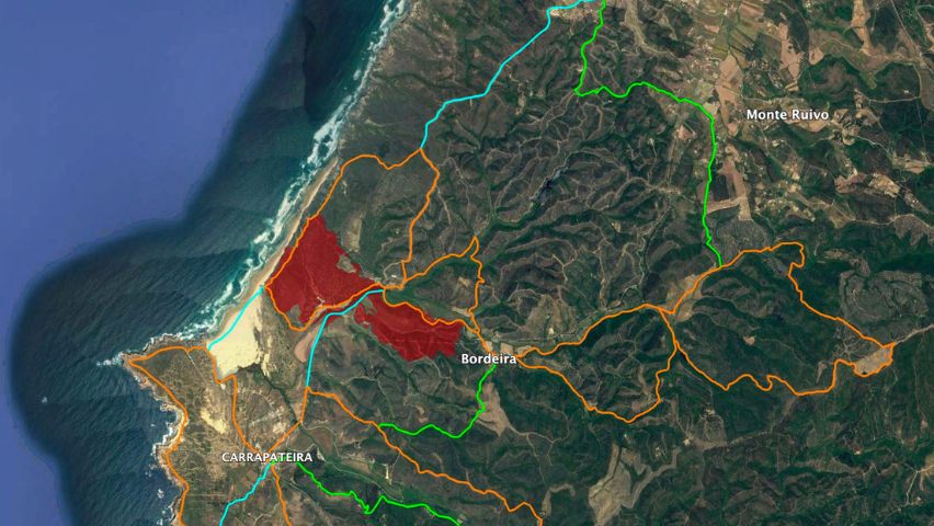
The red area represents the entirety of the burned area in the Bordeira parish. Source: ICNF.
Trails affected by the fires
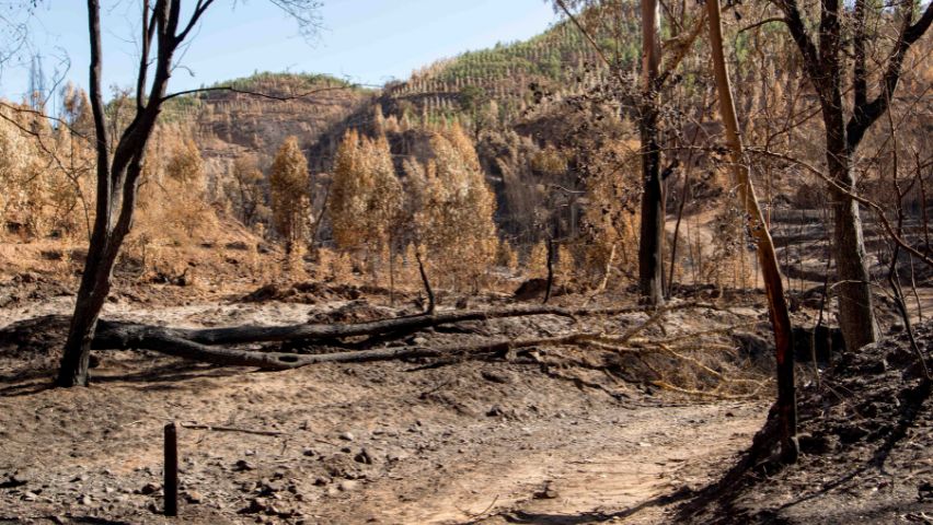
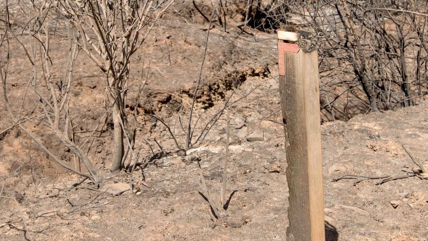
As visible on the maps, the fire spread through areas where Rota Vicentina trails pass.
Walking Trails
Historical Way
S. Teotónio » Odeceixe main section (17 km) and alternative (15 km)
Fishermen’s Trail
Arrifana » Carrapateira main section (20 km) and alternative (21.5 km)
Circular Routes
15 Odeceixe to the river (5 km / 14.5 km / 16 km)
18 From Bordeira to the Sea (6 km / 13.5 km)
Cycling Trails
MTB (Mountain Biking)
⚫ Trail 15 – Odeceixe
⚫ Trail 17 – Fóia
And now?
Rota Vicentina is conducting a comprehensive survey of the trail conditions and maintenance needs.
Soon, dates will be announced for those who wish to offer their help. There will be volunteering actions for specific trail sections, involving tasks such as re-marking and clearing obstructing vegetation. The groups will be small and will receive initial training on safety precautions and marking rules.
This challenging situation requires joint efforts to restore the quality of the affected trails, allowing everyone to continue enjoying Rota Vicentina trails safely.
We will update this article and the social media channels of Rota Vicentina with all the information regarding the circulation and maintenance of the trails affected by the fires. Until all maintenance work is completed, we recommend that you carry the GPS track of the routes with you. You can also use the OutdoorActive app, where you’ll find the tracks on the @rotavicentina official profile.
Irene Nunes was born in France, in 1986. She graduated in International Relations, but it was in Ecotourism and Environmental Education that she found her path. Various experiences in tourism, nature, and culture inspired her journey and brought her to the Southwest of Portugal. From 2017 until 2025, she has been responsible for the Walking […]
Our suggestions
Search by category
